Description
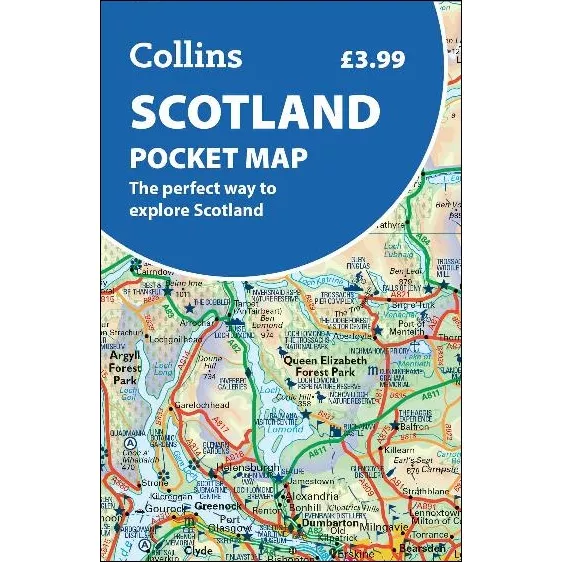
Scotland Pocket Map
Fully updated and very detailed for its size, the Scotland Pocket Map is a full-colour, double-sided map of the country. It shows the Central Belt, southern Scotland and northern England on one side, and northern Scotland including Orkney and Shetland on the reverse.
With its rugged landscapes and breathtaking scenery, Scotland is known for its cities, castles, and wildlife. Visitors can see historic sites, enjoy local food, and explore the Highlands. Scotland also has many islands, such as the Hebrides, Orkney, and Shetland, offering quiet beaches, wildlife, and small villages to discover.
This map features:
- Clear mapping at a scale of 8.7 miles to 1 inch
- National Tourist Routes showing best routes through the most scenic areas
- Top 100 places of interest
- Park and Ride locations
- Ideal companion to a sat-nav – it enables route planning and route sense-checking